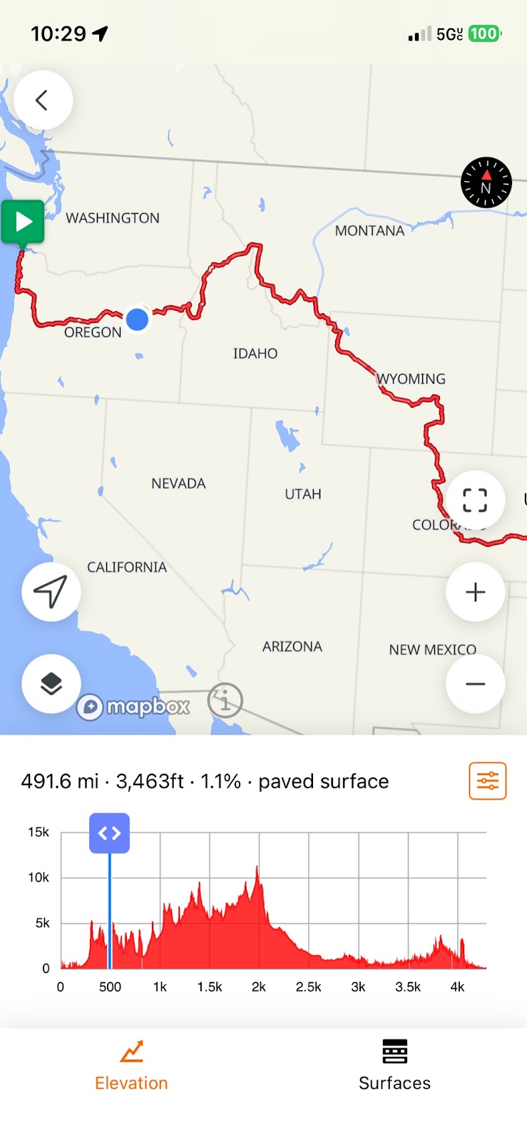
80 miles, 4580 ft ascent / 4945 descent, 7:25 saddle time, elevations: start 3451, max 5267, min 3083, finish 3083 ft.
 |
| Strawberry mountain wilderness |
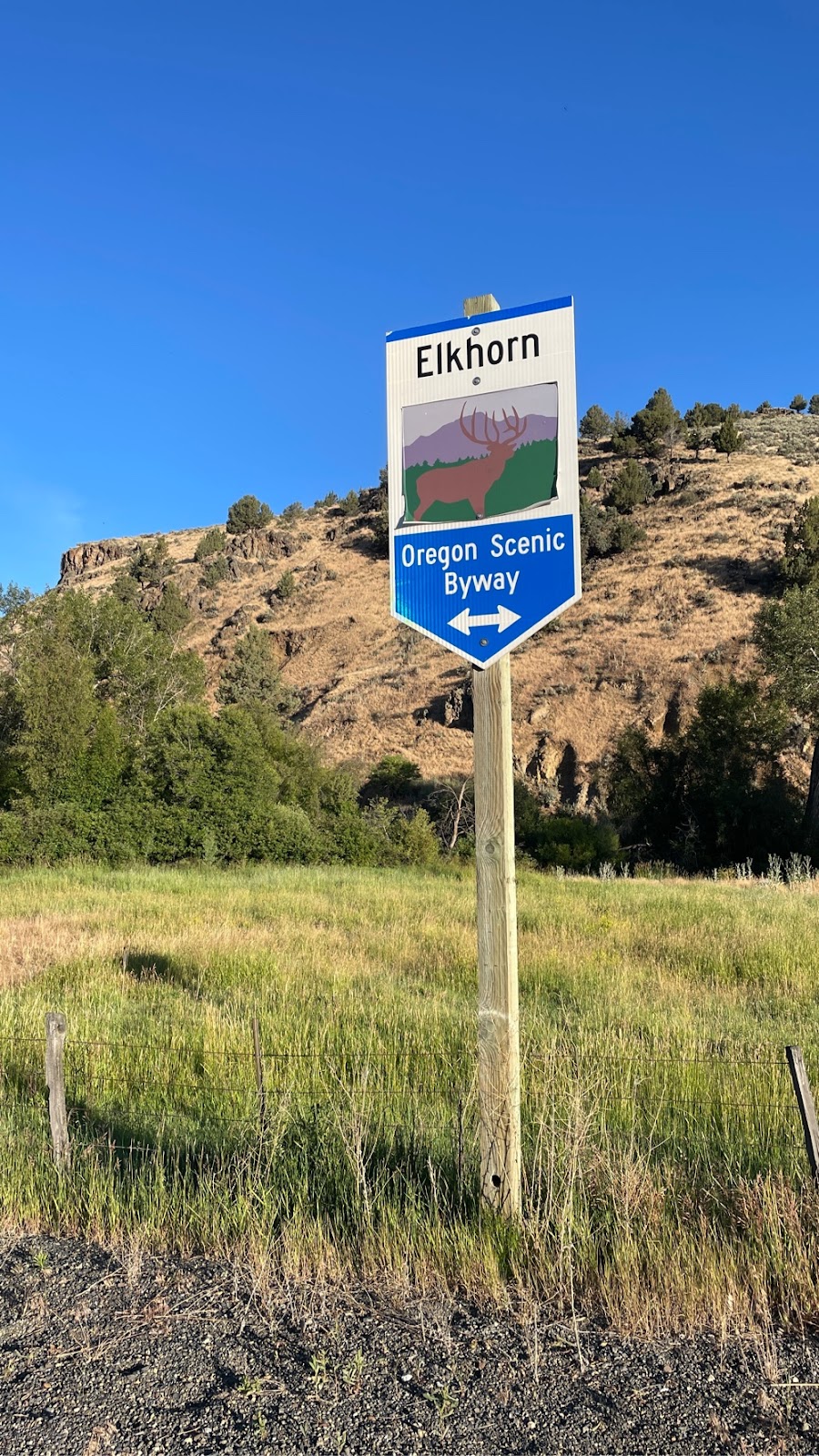
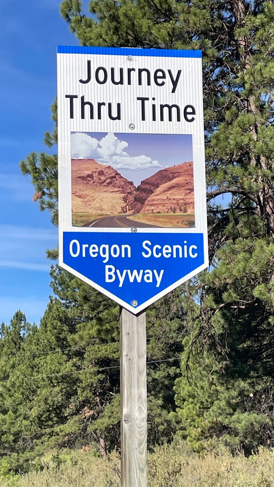
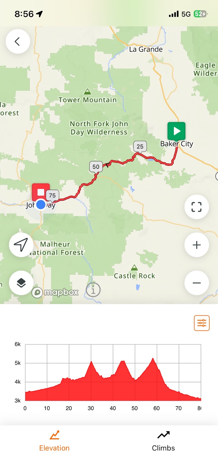
Today we had a lot of climbing and a lot of miles to do, so we got up at 0430 and were on the road at 0530. We had pre-staged muffins for breakfast to get quick carb hit and packed breakfast sandwiches for later down the road. It was cold (40’s) riding through the hills south from Baker City. After 7 weeks I have outfits worked out for any temperature. The trick is layering so that you can shed layers as it warms up. Oregon has developed a network of scenic byways. A couple days ago we were riding on the Hell’s Canyon byway. Today our route followed the Elkhorn and Journey Through Time byways.
Our route took us over three passes today. The first was over Sumpter pass, which was a climb of 846 ft in 3.1 mile. After an exciting downhill we began our ascent to Tipton Pass (774 ft in 3.3 miles), and finally Dixie Pass (1135 ft in 7.1 miles). The three passes are clear in the profile view of my route at the end of this post. The grades were not bad, never exceeding about 7% and mostly around 2 - 4%. That is one of the big differences between riding in the West compared with the Ozarks in Missouri or the Appalachians in Virginia. Grades in the latter are short, but are often above 10%.
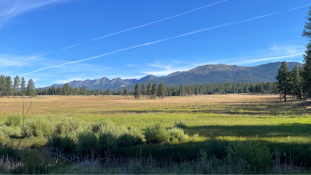
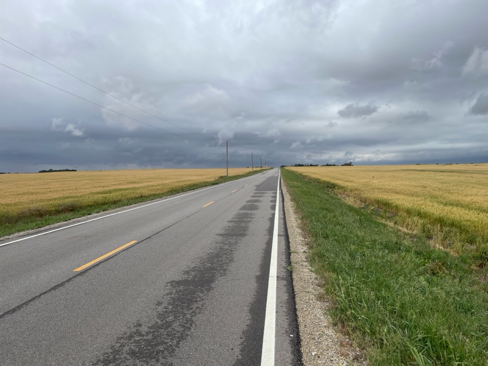
Our route turned west about 10 miles south of Baker City and we found ourselves following the Powder River through lush meadows surrounded by trees.
 |
| Sumpter Valley |
The Sumpter Valley was extensively mined during the gold rush days, so there are piles of gravel mine tailings that extend for miles. It really is a shame how they spoiled the pristine beauty of the valley through the use of dredges to extract gold. The piles of tailings have been there for about 150 years, and will probably be there fore many more.
Most of the roads follow creeks, river valleys and canyons, which is why the climbs are gradual and the grades moderate. The roads can get steep whenever we depart from a river or creek. Also, as we climb up to passes we travel up to the headwaters of creeks and rivers, and then the grades get steeper. It is typical for the grades to kick up as we approach the pass, and there are often false summits, which is never a good sight!
After crossing up and over the second pass we stopped for lunch in Austin Junction. The cafes and restaurants often don’t look like much from the outside, but I have been pleasantly surprised at how good the food has been in some of them. Today I had a turkey sandwich and a piece of Huckleberry pie. Huckleberries are a big deal out here. There are in pancakes, smoothies, pies, cobblers, cakes, lemonade, and …. They are like blueberrries, only sweeter. Pies are also sold in many cafes, lunch spots, bakeries, and restaurants. I have enjoyed pies and cobblers with various combinations of huckleberries, strawberries, peaches, rhubarb, raspberries, and assorted combinations of these.
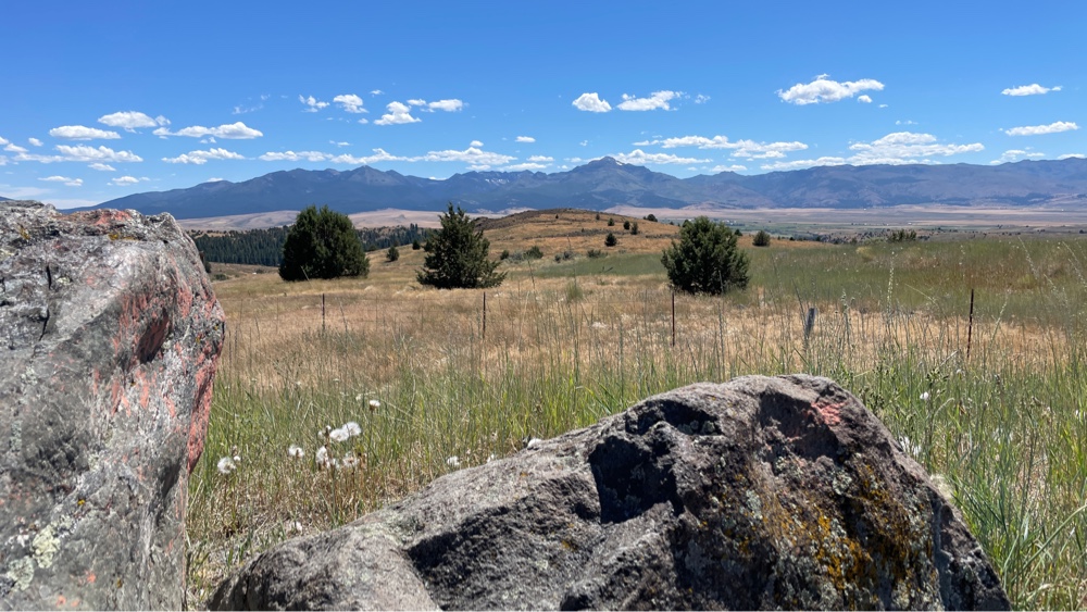
The first two passes we crossed today were tree covered, so they did not provide good views. However, upon crossing the Dixie Pass, the Strawbery Mountains and wilderness opened up in front of me (lead photo). It is (another) beautiful valley, however, it is no longer high desert. The valley is green, without extensive irrigation, and there are trees on the slopes. Each pass I have come over as I have traveled through the West reveals a valley and mountains in the distance with their own character. Some are very dry, the grasses are brown, and the mountains have few trees. Others are lush green and broad flowing rivers and lots of trees. Some of the mountains are smooth, while others are rocky. I have ridden through steep sided rocky gorges, up canyons with smooth sloping sides, and through broad valleys with meandering rivers. The variety of scenery and terrain in the west is tremendous.
Upon reaching the town of John Day, we checked into the Dreamers Lodge (really just a 2-level motel, and not a very good one at that), and headed out to the 1188 Brew pub for dinner. One nice thing about small towns, you can walk to just about everything. After sitting on my bike seat for 7 1/2 hours, I did not want to ride anywhere! Several of the towns we have been through have Friday Prime Rib specials. Brian and I have been sampling them as we have worked our way west, and tonight was our 4th.
Tomorrow we ride 74 miles to the town of Mitchell. The first 40 miles or so will be slightly downhill or flat, then we will begin a 23 mile uphill climb over the Keyes Creek summit, followed by a 7-mile downhill. We are planning to get an early start again because the temperatures have been climbing and tomorrow promises to be hotter than today (mid to upper 80’s). Also, the wind usually picks up in the afternoon, and it is always in our faces:(.
For Dylan, Olivia, Jackson and Liam, I am about 500 miles from my final destination of Astoria OR, and about 380 miles from the Pacific Ocean. I should be arriving in Astoria in about 11 days.
It’s so beautiful out there, you’re jogging a lot of memories for me; thanks!
ReplyDeleteCongratulations on surviving one tough day of climbing!
ReplyDelete